


Chapter 4: Finland’s Satellites and the Small Satellite Revolution
The development of satellites has transformed the way humanity observes Earth, communicates across continents, predicts weather, studies climate change, and explores the universe. While countries such as the United States, Russia, China, and India have launched large numbers of satellites over many decades, Finland has taken a different approach. Instead of competing in the production of massive and expensive spacecraft, Finland has become a pioneer in the rapidly growing field of small satellites. Through innovation, education, and engineering excellence, Finnish scientists and engineers have demonstrated that compact spacecraft can perform sophisticated scientific missions at a fraction of the traditional cost.
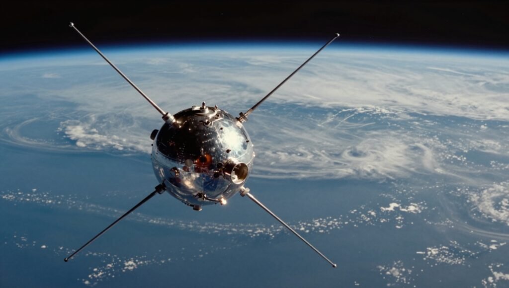
The satellite revolution began in 1957 when the Soviet Union launched Sputnik 1, the world’s first artificial satellite. This historic achievement marked the beginning of the Space Age and showed that objects could be placed into orbit around Earth. During the following decades, satellites became increasingly larger and more capable, carrying advanced scientific instruments, communication equipment, and imaging systems. However, these satellites were extremely expensive to build and launch, limiting access to only a handful of wealthy nations.
By the early twenty-first century, advances in electronics, miniaturization, batteries, solar panels, sensors, and computer technology created a new opportunity. Engineers realized that many scientific missions no longer required large spacecraft. Small satellites, particularly CubeSats, could accomplish valuable research while dramatically reducing development costs. Finland quickly recognized the potential of this technological revolution and became one of Europe’s leaders in small satellite innovation.
CubeSats are standardized miniature satellites typically built in units measuring 10 × 10 × 10 centimeters. These units can be combined to create larger spacecraft while maintaining compatibility with launch systems. Despite their small size, CubeSats can carry cameras, scientific sensors, communication systems, navigation equipment, onboard computers, and even miniature propulsion systems. Modern CubeSats are capable of performing tasks that once required satellites many times larger.
One of Finland’s most important achievements in this field was the development of Aalto-1, the country’s first satellite designed and built largely by university students and researchers. Launched in 2017, Aalto-1 represented years of collaboration among engineers, scientists, professors, and students. Although relatively small, the satellite carried sophisticated scientific instruments designed to study Earth’s radiation environment and demonstrate advanced imaging technology.
Aalto-1 included three major scientific payloads. One instrument measured energetic charged particles surrounding Earth, helping scientists better understand the radiation environment that affects satellites and astronauts. Another payload tested an innovative hyperspectral camera capable of observing Earth’s surface in many different wavelengths of light. Unlike ordinary cameras that capture only visible colors, hyperspectral imaging can detect subtle differences in vegetation, minerals, water quality, and environmental conditions. Such technology has applications in agriculture, forestry, environmental monitoring, and disaster response.
The satellite also carried an experimental electrostatic plasma brake, an innovative technology designed to reduce space debris. Space debris has become one of the greatest challenges facing modern space exploration. Thousands of inactive satellites and fragments of old spacecraft continue to orbit Earth, creating collision risks for operational satellites and future missions. The plasma brake generates an electric field that interacts with charged particles in Earth’s upper atmosphere, gradually slowing the satellite until it safely reenters the atmosphere. This environmentally responsible technology could help reduce the accumulation of orbital debris in the future.
The success of Aalto-1 demonstrated that Finnish universities could design, construct, launch, and operate sophisticated spacecraft. More importantly, it proved that students could participate directly in real space missions, gaining invaluable practical experience that traditional classroom education alone could never provide.
Following Aalto-1, Finland continued to expand its satellite capabilities. Researchers developed additional CubeSat missions focusing on Earth observation, communications, atmospheric science, and technology demonstrations. Each mission introduced new engineering innovations while strengthening Finland’s growing aerospace industry.
Among Finland’s most successful commercial achievements is the emergence of companies specializing in Earth observation satellites. These satellites continuously capture high-resolution images of Earth’s surface, allowing scientists, governments, and businesses to monitor environmental changes with remarkable precision. Satellite imagery supports agriculture by helping farmers optimize irrigation and fertilizer use. It assists forestry managers in tracking forest health and detecting illegal logging. Environmental agencies use satellite data to monitor pollution, wildfires, floods, droughts, and coastal erosion.
One Finnish company has gained international recognition for operating synthetic aperture radar (SAR) satellites. Unlike ordinary optical cameras, radar satellites can observe Earth’s surface through clouds, smoke, and even during nighttime. They transmit microwave signals toward Earth and measure the reflected energy to produce detailed images regardless of weather conditions. This capability is especially valuable in northern regions where cloud cover and long winter nights often limit conventional satellite observations.
Radar satellites are widely used for monitoring sea ice in the Arctic, tracking ships, measuring ground movement caused by earthquakes or volcanic activity, detecting oil spills, and observing flooding after natural disasters. Finland’s expertise in radar imaging has made it an important contributor to global environmental monitoring and maritime safety.
Satellite communications represent another important area of Finnish innovation. Modern satellites enable global internet connectivity, television broadcasting, emergency communications, navigation, and secure military communications. Finnish engineers have developed advanced communication systems that improve data transmission efficiency while reducing power consumption and increasing reliability. These technologies are increasingly important as satellite constellations expand to provide internet access to remote regions of the world.
Remote sensing has become one of the most valuable applications of Finnish satellites. Remote sensing refers to collecting information about Earth’s surface without direct physical contact. Satellites equipped with optical cameras, infrared sensors, radar systems, and multispectral instruments continuously gather enormous amounts of environmental data.
Scientists analyze this information to monitor forests, lakes, agricultural land, glaciers, snow cover, air quality, urban development, and ocean conditions. Finland, with its vast forests and thousands of lakes, benefits greatly from satellite-based environmental monitoring. Government agencies use satellite data to assess forest growth, detect insect outbreaks, monitor water quality, and manage natural resources more effectively.
Climate research also depends heavily on satellite observations. Finland’s Arctic location makes it especially sensitive to climate change. Satellites measure shrinking sea ice, changing snow cover, rising temperatures, and shifts in vegetation patterns across northern ecosystems. These observations contribute to international climate research and improve understanding of how environmental changes affect the entire planet.
Building a satellite requires expertise from numerous engineering disciplines. Mechanical engineers design the spacecraft structure to withstand launch vibrations and extreme temperature variations. Electrical engineers develop power systems, communication equipment, and onboard electronics. Computer scientists create flight software that controls satellite operations autonomously. Thermal engineers ensure that sensitive instruments remain within safe operating temperatures despite the harsh conditions of space.
Finnish universities emphasize interdisciplinary education by allowing students from different scientific backgrounds to collaborate on satellite projects. This teamwork reflects the realities of professional space missions, where success depends on close cooperation among specialists with diverse expertise.
Testing is one of the most critical stages of satellite development. Before launch, every component undergoes rigorous evaluation under simulated space conditions. Satellites are placed inside vacuum chambers that reproduce the near-perfect vacuum of space. Thermal testing exposes equipment to temperatures ranging from intense heat to extreme cold. Vibration tests simulate the powerful forces experienced during rocket launch. Electromagnetic compatibility tests ensure that electronic systems do not interfere with one another.
These demanding procedures guarantee that satellites will operate reliably after reaching orbit, where repairs are usually impossible.
Modern satellite operations continue long after launch. Ground stations communicate with satellites by transmitting commands and receiving scientific data. Engineers continuously monitor spacecraft health, battery performance, communication systems, orbital position, and instrument status. Finnish researchers have developed sophisticated software that automates many routine operations while allowing rapid response to unexpected technical issues.
Artificial intelligence is beginning to transform satellite operations as well. Machine learning algorithms can analyze enormous quantities of satellite imagery far more quickly than human analysts. AI systems automatically identify wildfires, floods, illegal deforestation, crop diseases, marine pollution, and other environmental changes. Future Finnish satellites are expected to include onboard artificial intelligence capable of processing data before transmitting only the most important information back to Earth, reducing communication demands and improving mission efficiency.
Sustainability has become an increasingly important consideration in satellite engineering. Finland actively supports responsible space operations by developing technologies that reduce orbital debris, improve satellite longevity, and minimize environmental impacts. Future spacecraft may incorporate recyclable materials, more efficient propulsion systems, and autonomous collision avoidance technologies to ensure safer use of Earth’s orbital environment.
Looking ahead, Finnish satellite technology is expected to play an even greater role in global science and industry. Advances in quantum communication, hyperspectral imaging, autonomous spacecraft, distributed satellite constellations, and artificial intelligence will create new opportunities for innovation. Small satellites will increasingly work together in coordinated networks, providing continuous global observations that support climate science, disaster management, agriculture, transportation, and national security.
Finland’s success in the small satellite revolution demonstrates that technological innovation is not determined by the size of a nation but by the creativity of its scientists and engineers. By embracing miniaturization, advanced electronics, interdisciplinary education, and international collaboration, Finland has established itself as a respected leader in modern satellite technology. Its achievements continue to influence the future of space exploration while delivering practical benefits that improve daily life on Earth.